Headlines From Our Twitter Feed

Showing posts with label hurricane. Show all posts

Wednesday, August 28, 2019

Hurricane Dorian

2 PM Advisory from the National Hurricane Center


BULLETIN
Hurricane Dorian Intermediate Advisory Number 17A
NWS National Hurricane Center Miami FL       AL052019
200 PM AST Wed Aug 28 2019

...DORIAN BECOMES A HURRICANE NEAR ST. THOMAS IN THE U.S. VIRGIN
ISLANDS...

...MULTIPLE OBSERVATIONS OF HURRICANE-FORCE WINDS IN ST. THOMAS...


SUMMARY OF 200 PM AST...1800 UTC...INFORMATION
----------------------------------------------
LOCATION...18.3N 65.0W
ABOUT 0 MI...0 KM W OF ST. THOMAS
MAXIMUM SUSTAINED WINDS...75 MPH...120 KM/H
PRESENT MOVEMENT...NW OR 315 DEGREES AT 13 MPH...20 KM/H
MINIMUM CENTRAL PRESSURE...997 MB...29.44 INCHES


WATCHES AND WARNINGS
--------------------

CHANGES WITH THIS ADVISORY:

The Tropical Storm Watch for the Dominican Republic has been
discontinued.

SUMMARY OF WATCHES AND WARNINGS IN EFFECT:

A Hurricane Warning is in effect for...
* Vieques and Culebra
* U.S. Virgin Islands
* British Virgin Islands

A Hurricane Watch is in effect for...
* Puerto Rico

A Tropical Storm Warning is in effect for...
* Puerto Rico

A Hurricane Warning means that hurricane conditions are expected
somewhere within the warning area, in this case within the next 6 to
12 hours.

A Hurricane Watch means that hurricane conditions are possible
within the watch area, in this case within the next 6 to 12 hours.
For storm information specific to your area in the United States,
including possible inland watches and warnings, please monitor
products issued by your local National Weather Service forecast
office. For storm information specific to your area outside of the
United States, please monitor products issued by your national
meteorological service.

DISCUSSION AND OUTLOOK
----------------------
At 200 PM AST (1800 UTC), the center of Hurricane Dorian was located
near latitude 18.3 North, longitude 65.0 West. Dorian is moving
toward the northwest near 13 mph (20 km/h), and this motion is
expected to continue for the next day or two. On this track, Dorian
should continue to move near or over the U.S. and British Virgin
Islands this afternoon and then move over the open Atlantic well
east of the southeastern Bahamas.

Maximum sustained winds have increased to near 75 mph (120 km/h)
with higher gusts.  Dorian is forecast to continue strengthening
during the next few days over the Atlantic waters.
Hurricane-force winds extend outward up to 20 miles (30 km) to the
north and east of the center. Tropical-storm-force winds extend
outward up to 80 miles (130 km) primarily to the east of the center.
An elevated weather station on Buck Island just south of St. Thomas
reported a sustained wind of 82 mph (132 km/h) and a gust of 111 mph
(178 km/h).

The estimated minimum central pressure from nearby observations is
997 mb (29.44 inches).


HAZARDS AFFECTING LAND
----------------------
RAINFALL:  Dorian is expected to produce the following rainfall
accumulations:
Northern Leeward Islands...1 to 3 inches.
Eastern Puerto Rico, the Virgin Islands, and the northwest
Bahamas...4 to 6 inches, isolated 10 inches
Western Puerto Rico and the central Bahamas...2 to 4 inches
Coastal sections of the Southeast United States...4 to 8 inches,
isolated 10 inches. This rainfall may cause life-threatening flash floods.

WIND:  Hurricane conditions are ongoing over portions of the U.S.
Virgin Islands, and are expected over Vieques, Culebra, and the
British Virgin Islands today.  Tropical storm conditions are
expected in Puerto Rico this afternoon and tonight.
Wind speeds atop and on the windward sides of hills and mountains
are often up to 30 percent stronger than the near-surface winds
indicated in this advisory, and in some elevated locations could be
even greater.

SURF:   Swells are expected to increase later today across the U.S.
and British Virgin Islands and along the southern coasts of Puerto
Rico and Hispaniola, and they could cause life-threatening surf and
rip current conditions.  Please consult products from your local
weather office.

NEXT ADVISORY
-------------
Next complete advisory at 500 PM AST.
$$
Forecaster Avila


A map of storm shelters in Puerto Rico available ahead of #Dorian can be found at this link:


Tuesday, September 19, 2017

Hurricane Maria Coverage

OH, GOD...NOW WHAT?!?

DANGEROUS HURRICANE MARIA THREATENS PR


Hurricane Maria is expected to go through Puerto Rico, entering from the southeast, on Wednesday morning, even as the island is still dealing with the aftermath of its brush with Hurricane Irma little over a week ago. The latest National Hurricane Center bulletin is available below. Please keep checking our Twitter feed (featured below, after the bulletin) for the latest hurricane news.


BULLETIN
Hurricane Maria Advisory Number  16
NWS National Hurricane Center Miami FL       AL152017
1100 PM AST Tue Sep 19 2017

...EYE OF POTENTIALLY CATASTROPHIC CATEGORY 5 HURRICANE MARIA
NEARING ST. CROIX...
...CORE EXPECTED TO REACH SOUTHEASTERN PUERTO RICO WEDNESDAY
MORNING...


SUMMARY OF 1100 PM AST...0300 UTC...INFORMATION
-----------------------------------------------
LOCATION...17.3N 64.7W
ABOUT 30 MI...45 KM SSE OF ST. CROIX
ABOUT 120 MI...190 KM SE OF SAN JUAN PUERTO RICO
MAXIMUM SUSTAINED WINDS...175 MPH...280 KM/H
PRESENT MOVEMENT...WNW OR 300 DEGREES AT 10 MPH...17 KM/H
MINIMUM CENTRAL PRESSURE...909 MB...26.85 INCHES


WATCHES AND WARNINGS
--------------------
CHANGES WITH THIS ADVISORY:

None

SUMMARY OF WATCHES AND WARNINGS IN EFFECT:

A Hurricane Warning is in effect for...
* U.S. Virgin Islands
* British Virgin Islands
* Puerto Rico, Culebra, and Vieques
* Dominican Republic from Cabo Engano to Puerto Plata


From our Twitter feed:


Tuesday, September 5, 2017

Hurricane Irma Coverage

A MONSTER APPROACHES

IRMA NOW A STRONG CAT 5 STORM


For the latest on Irma, check out our Twitter feed. 

Scroll down past tweets below for the National Hurricane Center's Advisory.  


Latest from the National Hurricane Center as of 11 PM AST:


BULLETIN
Hurricane Irma Advisory Number  28
NWS National Hurricane Center Miami FL       AL112017
1100 PM AST Tue Sep 05 2017

...POTENTIALLY CATASTROPHIC CATEGORY 5 HURRICANE IRMA GETTING VERY
CLOSE TO THE NORTHERN LEEWARD ISLANDS...


SUMMARY OF 1100 PM AST...0300 UTC...INFORMATION
-----------------------------------------------
LOCATION...17.4N 61.1W
ABOUT 50 MI...80 KM ENE OF ANTIGUA
ABOUT 50 MI...75 KM ESE OF BARBUDA
MAXIMUM SUSTAINED WINDS...185 MPH...295 KM/H
PRESENT MOVEMENT...WNW OR 285 DEGREES AT 15 MPH...24 KM/H
MINIMUM CENTRAL PRESSURE...916 MB...27.05 INCHES


WATCHES AND WARNINGS
--------------------
CHANGES WITH THIS ADVISORY:

None.

SUMMARY OF WATCHES AND WARNINGS IN EFFECT:

A Hurricane Warning is in effect for...
* Antigua, Barbuda, Anguilla, Montserrat, St. Kitts, and Nevis
* Saba, St. Eustatius, and Sint Maarten
* Saint Martin and Saint Barthelemy
* British Virgin Islands
* U.S. Virgin Islands
* Puerto Rico, Vieques, and Culebra
* Dominican Republic from Cabo Engano to the northern border with
Haiti
* Guadeloupe

A Hurricane Watch is in effect for...
* Haiti from the northern border with the Dominican Republic to Le
Mole St. Nicholas
* Turks and Caicos Islands
* Southeastern Bahamas
* Cuba from Matanzas province eastward to Guantanamo province

A Tropical Storm Warning is in effect for...
* Dominica
* Dominican Republic from south of Cabo Engano westward to the
southern border with Haiti

A Tropical Storm Watch is in effect for...
* Haiti from south of Le Mole St. Nicholas to Port-Au-Prince

A Hurricane Warning means that hurricane conditions are expected
somewhere within the warning area.  Preparations to protect life and
property should be rushed to completion.

A Hurricane Watch means that hurricane conditions are possible
within the watch area.  A watch is typically issued 48 hours
before the anticipated first occurrence of tropical-storm-force
winds, conditions that make outside preparations difficult or
dangerous.

A Tropical Storm Warning means that tropical storm conditions are
expected somewhere within the warning area.

A Tropical Storm Watch means that tropical storm conditions are
possible within the watch area, generally within 48 hours.

Interests elsewhere in the Dominican Republic and Haiti, as
well as Cuba, the central and northwestern Bahamas, and Florida
should monitor the progress of Irma.

For storm information specific to your area in the United
States, including possible inland watches and warnings, please
monitor products issued by your local National Weather Service
forecast office. For storm information specific to your area outside
the United States, please monitor products issued by your national
meteorological service.


DISCUSSION AND 48-HOUR OUTLOOK
------------------------------
At 1100 PM AST (0300 UTC), the eye of Hurricane Irma was located
near latitude 17.4 North, longitude 61.1 West.  Irma is moving
toward the west-northwest near 15 mph (24 km/h), and this motion is
expected to continue for the next couple of days.  On the forecast
track, the extremely dangerous core of Irma will move over portions
of the northern Leeward Islands tonight and early Wednesday, move
near or over portions of the northern Virgin Islands Wednesday, and
pass near or just north of Puerto Rico late Wednesday and Wednesday
night.

Maximum sustained winds remain near 185 mph (295 km/h) with higher
gusts.  Irma is a category 5 hurricane on the Saffir-Simpson
Hurricane Wind Scale.  Some fluctuations in intensity are likely
during the next day or two, but Irma is forecast to remain a
powerful category 4 or 5 hurricane during the next couple of days.

Hurricane-force winds extend outward up to 50 miles (85 km) from the
center and tropical-storm-force winds extend outward up to 175 miles
(280 km).

The minimum central pressure estimated from Air Force and NOAA
Hurricane Hunter aircraft observations is 916 mb (27.05 inches).


HAZARDS AFFECTING LAND
----------------------
STORM SURGE:  The combination of a life-threatening storm surge and
large breaking waves will raise water levels ABOVE NORMAL TIDE
LEVELS by the following amounts within the hurricane warning area
near and to the north of the center of Irma.  Near the coast, the
surge will be accompanied by large and destructive waves.

Northern Leeward Islands...7 to 11 ft
Turks and Caicos Islands...15 to 20 ft
Southeastern Bahamas...15 to 20 ft
Northern coast of the Dominican Republic...3 to 5 ft
Northern coast of Haiti and the Gulf of Gonave...1 to 3 ft

The combination of a life-threatening storm surge and the tide will
cause normally dry areas near the coast to be flooded by rising
waters moving inland from the shoreline.  The water is expected to
reach the following HEIGHTS ABOVE GROUND if the peak surge occurs at
the time of high tide...

British and U.S. Virgin Islands except St. Croix...7 to 11 ft
Northern coast of Puerto Rico...3 to 5 ft
Southern coast of Puerto Rico and St. Croix...1 to 2 ft

The deepest water will occur along the immediate coast in areas of
onshore winds, where the surge will be accompanied by large and
destructive waves.  Surge-related flooding depends on the relative
timing of the surge and the tidal cycle, and can vary greatly over
short distances.  For information specific to your area, please see
products issued by your local National Weather Service forecast
office.

WIND:  Hurricane conditions are expected within the hurricane
warning area in the Leeward Islands tonight, with tropical storm
conditions beginning within a couple of hours.  Hurricane
conditions are expected to begin within the hurricane warning area
in the British and U.S. Virgin Islands and Puerto Rico on Wednesday,
with tropical storm conditions beginning tonight.  Hurricane
conditions are expected to begin within the hurricane warning area
in the Dominican Republic early Thursday, with tropical storm
conditions beginning Wednesday night.

Hurricane and tropical storm conditions are possible within the
watch area in Haiti, the Turks and Caicos Islands, and the
southeastern Bahamas by early Thursday.

RAINFALL:  Irma is expected to produce the following rain
accumulations through Thursday:

Northern Leeward Islands...8 to 12 inches, isolated 20 inches
Northeast Puerto Rico and the British and U.S. Virgin Islands
except St. Croix...4 to 10 inches, isolated 15 inches
Southwest Puerto Rico, the southern Leeward Islands, and
St. Croix...2 to 4 inches

Irma is expected to produce the following rain accumulations
Wednesday through Saturday:

Southeast Bahamas and Turks and Caicos...8 to 12 inches, isolated 20
inches
Northern Dominican Republic and northern Haiti...4 to 10 inches,
isolated 15 inches
Southwest Haiti...1 to 4 inches

These rains could cause life-threatening flash floods and mudslides.

SURF:  Swells generated by Irma will affect the northern Leeward
Islands, Puerto Rico, the Virgin Islands, the southeastern Bahamas,
the Turks and Caicos Islands, and the northern coast of the
Dominican Republic during the next several days.  These swells are
likely to cause life-threatening surf and rip current conditions.
Please consult products from your local weather office.


NEXT ADVISORY
-------------
Next intermediate advisory at 200 AM AST.
Next complete advisory at 500 AM AST.

$$
Forecaster Pasch


Monday, September 4, 2017

Hurricane Irma Menaces Puerto Rico


Monitor our Twitter feed for the latest on Irma


From Caribbean Business:

"Hurricane Irma grew into a powerful Category 4 storm Monday as it approached the northeastern Caribbean and was forecast to begin buffeting the region Tuesday...Emergency officials warned that the storm could dump up to 10 inches (25 centimeters) of rain, unleash landslides and dangerous flash floods and generate waves of up to 23 feet (7 meters) as the storm drew closer...
“We’re looking at Irma as a very significant event,” Ronald Jackson, executive director of the Caribbean Disaster Emergency Management Agency, said by phone. “I can’t recall a tropical cone developing that rapidly into a major hurricane prior to arriving in the central Caribbean...”
____________________________________________________________

The latest from the National Hurricane Center is below:
Hurricane Irma Advisory Number  23
NWS National Hurricane Center Miami FL       AL112017
1100 PM AST Mon Sep 04 2017

...HURRICANE WARNINGS ISSUED FOR PUERTO RICO AND THE VIRGIN
ISLANDS...


SUMMARY OF 1100 PM AST...0300 UTC...INFORMATION
-----------------------------------------------
LOCATION...16.7N 55.6W
ABOUT 410 MI...660 KM E OF THE LEEWARD ISLANDS
MAXIMUM SUSTAINED WINDS...140 MPH...220 KM/H
PRESENT MOVEMENT...W OR 270 DEGREES AT 13 MPH...20 KM/H
MINIMUM CENTRAL PRESSURE...943 MB...27.85 INCHES


WATCHES AND WARNINGS
--------------------
CHANGES WITH THIS ADVISORY:

The Hurricane Watch for the U.S. Virgin Islands, Puerto Rico,
Vieques, and Culebra has been changed to a Hurricane Warning.

The government of Antigua has changed the Hurricane Watch for the
British Virgin Islands to a Hurricane Warning.

SUMMARY OF WATCHES AND WARNINGS IN EFFECT:

A Hurricane Warning is in effect for...
* Antigua, Barbuda, Anguilla, Montserrat, St. Kitts, and Nevis
* Saba, St. Eustatius, and Sint Maarten
* Saint Martin and Saint Barthelemy
* British Virgin Islands
* U.S. Virgin Islands
* Puerto Rico, Vieques, and Culebra

A Hurricane Watch is in effect for...
* Guadeloupe

A Tropical Storm Warning is in effect for...
* Guadeloupe

A Tropical Storm Watch is in effect for...
* Dominica

A Hurricane Warning means that hurricane conditions are expected
somewhere within the warning area.  A warning is typically issued
36 hours before the anticipated first occurrence of tropical-storm-
force winds, conditions that make outside preparations difficult or
dangerous.  Preparations to protect life and property should be
rushed to completion.

A Hurricane Watch means that hurricane conditions are possible
within the watch area.  A watch is typically issued 48 hours before
the anticipated first occurrence of tropical-storm-force winds,
conditions that make outside preparations difficult or dangerous.

A Tropical Storm Warning means that tropical storm conditions are
expected somewhere within the warning area within 36 hours.

A Tropical Storm Watch means that tropical storm conditions are
possible within the watch area, generally within 48 hours.

Interests in the Dominican Republic, Haiti, the Turks and Caicos
Islands, Cuba, and the southeastern and central Bahamas should
monitor the progress of Irma.


DISCUSSION AND 48-HOUR OUTLOOK
------------------------------
At 1100 PM AST (0300 UTC), the eye of Hurricane Irma was located
by an Air Force Hurricane Hunter aircraft near latitude 16.7 North,
longitude 55.6 West.  Irma is moving toward the west near 13 mph (20
km/h) and this general motion is expected to continue into Tuesday,
followed by a turn toward the west-northwest late Tuesday.  On the
forecast track, the center of Irma will move near or over portions
of the northern Leeward Islands Tuesday night and early Wednesday.

Maximum sustained winds are near 140 mph (220 km/h) with higher
gusts.  Irma is a category 4 hurricane on the Saffir-Simpson
Hurricane Wind Scale.  Additional strengthening is forecast during
the next 48 hours.

Hurricane-force winds extend outward up to 45 miles (75 km) from the
center and tropical-storm-force winds extend outward up to 140 miles
(220 km).

The minimum central pressure estimated from Hurricane
Hunter observations is 943 mb (27.85 inches).


HAZARDS AFFECTING LAND
----------------------
STORM SURGE:  The combination of a dangerous storm surge and large
breaking waves will raise water levels by as much as 6 to 9 feet
above normal tide levels along the coasts of the extreme northern
Leeward Islands within the hurricane warning area near and to the
north of the center of Irma.  Near the coast, the surge will be
accompanied by large and destructive waves.

The combination of a dangerous storm surge and the tide will cause
normally dry areas near the coast to be flooded by rising waters
moving inland from the shoreline.  The water is expected to reach
the following heights above ground if the peak surge occurs at the
time of high tide...

British and U.S. Virgin Islands except St. Croix...4 to 6 ft
Northern coast of Puerto Rico...2 to 4 ft
Southern coast of Puerto Rico and St. Croix...1 to 2 ft

The deepest water will occur along the immediate coast in areas of
onshore winds, where the surge will be accompanied by large and
destructive waves.  Surge-related flooding depends on the relative
timing of the surge and the tidal cycle, and can vary greatly over
short distances.  For information specific to your area, please see
products issued by your local National Weather Service forecast
office.

WIND:  Hurricane conditions are expected within the hurricane
warning area by Tuesday night, with tropical storm conditions
expected by late Tuesday.  Hurricane conditions are possible within
the hurricane watch area in the Virgin Islands and Puerto Rico by
late Wednesday, with tropical storm conditions possible by early
Wednesday.  Tropical Storm conditions are expected within the
tropical storm warning area by late Tuesday.

RAINFALL:  Irma is expected to produce total rainfall accumulations
of 3 to 6 inches with isolated maximum amounts of 10 inches across
the northern Leeward Islands, the British and U.S. Virgin Islands,
and Puerto Rico.  These rainfall amounts may cause life-threatening
flash floods and mudslides.

SURF:  Swells generated by Irma will affect the northern Leeward
Islands, Puerto Rico, and the U.S. and British Virgin Islands
during the next several days.  These swells are likely to cause
life-threatening surf and rip current conditions. Please consult
products from your local weather office.


NEXT ADVISORY
-------------
Next intermediate advisory at 200 AM AST.
Next complete advisory at 500 AM AST.

Thursday, August 3, 2017

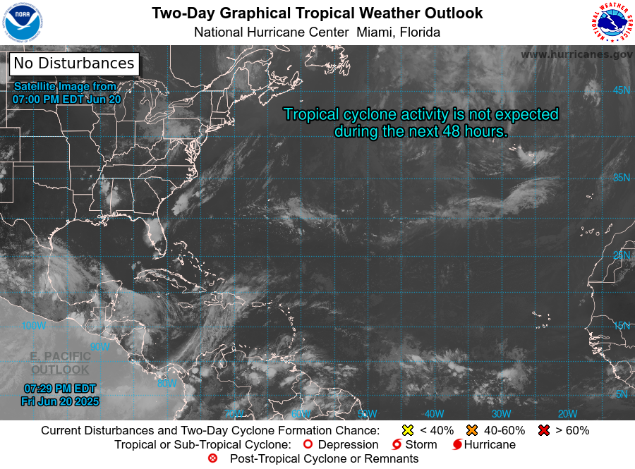
NWS Monitors Weather System In East Atlantic


From The National Hurricane Center:

Tropical Weather Outlook
NWS National Hurricane Center Miami FL
800 AM EDT Thu Aug 3 2017

For the North Atlantic...Caribbean Sea and the Gulf of Mexico:

A large area of showers and thunderstorms centered about 500 miles
southeast of the Cabo Verde Islands is associated with a vigorous
tropical wave. Environmental conditions are forecast to be conducive
for gradual development, and a tropical depression could form by
early next week over the eastern or central tropical Atlantic
Ocean. This system is forecast to move toward the west or
west-northwest at 10 to 15 mph for the next several days.
* Formation chance through 48 hours...low...30 percent.
* Formation chance through 5 days...medium...60 percent.


Tuesday, October 4, 2016

Puerto Rico News Digest For October 4, 2016


WEATHER SYSTEM COULD BECOME STORM


F


From The National Hurricane Center:

"Showers and thunderstorms continue in association with a low pressure area 
located about 500 miles northeast of Puerto Rico. Satellite wind data indicate 
that the low is producing winds to gale force, and the system could become su-
fficiently well organized to result in the formation of a tropical storm later today.  
The low is expected to move generally northwestward at 10 to 15 mph over the 
next few days, and upper-level winds are forecast to become less conducive for 
development. Formation chance through 48 hours...high...80 percent. Formation 
chance through 5 days...high...80 percent..."


BOARD SETS DEADLINE FOR TURNAROUND PLAN


From The San Juan Daily Star:

"Puerto Rico’s newly created federal oversight board on Friday set an Oct.14
deadline for the island’s governor to draft a fiscal turnaround plan, as protesters
at its first public meeting compared the board to “slavery” and said it was “pilla-
ging Puerto Rico.” The board asked Gov. Alejandro García Padilla to present a
plan laying out his vision for stabilizing Puerto Rico, which is grappling with $70
billion in debt, a 45 percent poverty rate and a decade-long recession..."


DONAHUE TO TESTIFY ABOUT BLACKOUT


From Caribbean Business:

"The Senate Committee on Energy and Water Resources has summoned the ch-
ief restructuring officer of the Puerto Rico Electric Power Authority (Prepa), Li-
sa Donahue, to appear Tuesday as part of the hearings that began last week to in-
vestigate the possible reasons that led to the collapse the electrical system on Sep-
tember 21 and the delay in the restoration of electrical service. The president of the
committee, Popular Democratic Party Sen. Ramón Luis Nieves, said that Donahue
should give details before the Senate panel about the work done by her firm, Alix
Partners, since it was hired by Prepa in September 2014 to restructure the utility’s
debt and transform the operations of the public corporation..."


CUSTOMS SEIZES $1.5M IN COUNTERFEIT GOODS


From News Is My Business:


"U.S. Customs and Border Protection San Juan Field Operations announced today
that 206 seizures where made of counterfeit products, valued at $1.5 million, wh-
ich were illegally imported into Puerto Rico via international mail. A wide range
of counterfeited products was seized during the enforcement effort, called “Oper-
ation Silver Snake 2,” to include: consumer products, apparel, footwear, textiles,
pharmaceuticals, and more, the agency said. Various international mail packages
inspected by CBP officers at the San Juan International Mail Branch revealed pro-
ducts that infringedintellectual property rights. The majority of the seized products
originated in China, the agency said..."


Wednesday, June 1, 2016

Puerto Rico News Digest For June 1, 2016


HURRICANE SEASON STARTS TODAY


From The San Juan Daily Star:

"U.S. government forecasters expect a near-normal Atlantic hurricane season,
after three relatively slow years. But they also say climate conditions that influ-
ence storm development are making it difficult to predict how many hurricanes
and tropical storms will arise over the next six months. The National Oceanic
and Atmospheric Administration’s outlook released late last week called for a
near-normal season with 10 to 16 named storms, with four to eight hurricanes
and one to four “major” ones with winds reaching 111 mph and up..."


SENATE HONORS VETS ON MEMORIAL DAY


From Caribbean Business:

"The Senate received Monday a group of veterans and their families, as well as
officers, to commemorate Memorial Day in a ceremony at a Capitol monument
honoring the fallen in various wars. Sen. Miguel Pereira, chairman of the Judici-
ary, Security and Veterans Committee, hosted the activity and received Col. Mar-
ta Carcana, adjutant general of the National Guard of Puerto Rico, who delivered
a message to attendees. Also attending the ceremony were Jorge Cases, spokes-
man for the Veterans Advocate Office; former Puerto Rico National Guard Adjt.
Gen. Luis González Vale and former San Juan Mayor Héctor Luis Acevedo, who
retired as a lieutenant colonel from the U.S. Army Reserve in 1998..."


OMB: PAYING DEBT COULD MEAN LAYOFFS


From News Is My Business:

"If the government of Puerto Rico were to pay the full amount due next year in
GO debt would require laying off more than 3,400 public workers, among other
adjustments, Luis Cruz, executive director of the Office of Management and Bud-
get, told members of the House Finance Committee during budget hearings Mon-
day. In his testimony, Cruz said the $209 million set aside from the General Fund
will go to cover GO interest payment, but no principal amount, which would total
$1.4 billion next fiscal year..."


SAN JUAN TAXI DRIVERS PROTEST UBER


From Fox News Latino:

"Traffic chaos prevailed in San Juan on Tuesday as taxi drivers and  truckers
protested the arrival in Puerto Rico of Uber, the private ride-hailing service,
which links passengers and drivers via a mobile application. On Tuesday mor-
ning it was difficult to find taxis on the capital streets, while some tourist excur-
sions had to be cancelled when drivers with certain tourist operators refused to
work..."


Monday, October 5, 2015

Puerto Rico News Digest For October 5, 2015


TRACES FOUND OF MISSING SHIP


From Fox News Latino:

Aircraft and ships searching off the Bahamas islands for a U.S. cargo ship
that lost contact during Hurricane Joaquin have found more debris and clues
but no definitive word yet on the fate of the vessel or the 33 people on board.
The owner of the 790-foot El Faro said a container that appears to have come
from the ship was found, while the Coast Guard said it had located a debris
field that included what appeared to be pieces of container. Searchers have
also spotted an oil sheen and found a life ring from the El Faro. Chief Petty
Officer Bobby Nash said it was too early to come to any conclusion. Two
Coast Guard cutters, the Northland and Resolute, were expected to continue
searching overnight Sunday as the aircraft returned to their bases.


POLICE SEIZE $5.4 MILLION DRUG SHIPMENT


From Caribbean Business:

"Authorities are searching for three suspects who allegedly attempted to
smuggle $5.4 million worth of drugs into Puerto Rico from the Dominican
Republic. Police said they arrested Teófilo Tineo González, a 36-year-old
Dominican man, after seizing about 518 pounds (235 kilograms) of cocai-
ne and heroin and a 22-foot (6.7-meter) boat on the coast west  of San Juan,
but three other suspects got away. Police Superintendent José Caldero said
authorities were hunting for three others they believe were aboard the boat
that left the Dominican Republic for Puerto Rico on Wednesday night..."


RESERVOIR LEVELS GO UP OVER THE WEEKEND


Rains over this past weekend have raised the water level at the Carraízo and
La Plata reservoirs, both of which serve the bulk of the San Juan metro area.
La Plata went up by 47 centimeters from Sunday morning to Monday morn-
ing, for a level of 40.50 meters. La Plata's users, however, are  still a ways
away from being taken off the current 24-hour water rationing plan they are
currently under. The reservoir would have to reach at least 43 meters for ra-
tioning to be discontinued. The Carraízo reservoir saw its water level rise over
the weekend to 38.47 meters, staving off for now a return to a rationing plan
for its 160,000 users. Its level rose by 26 centimeters from Sunday to Monday.


EPA FINALIZES PLAN FOR CONTAMINATED WELL


From The San Juan Daily Star:

The U.S. Environmental Protection Agency (EPA) finalized a plan to use
natural processes along with the continued use of a system that the federal
agency had already installed to treat contaminated groundwater at the Coro-
zal Well Superfund Site in Corozal, officials announced Thursday. Previou-
sly, the EPA installed a system that uses carbon to address pollutants as an
initial step to address the risks posed by people drinking contaminated gro-
undwater. Data collected since EPA installed the system confirms that there
are no levels of concern at the well. The system will remain in place as a sa-
feguard.


Tuesday, August 25, 2015

Tropical Storm Erika Forms In Atlantic


5:45 PM UPDATE: Last location for Erika: 15.6N 52.8W, about 605
miles east of Antigua. Maximum sustained winds 40 mph. Erika is
moving west at 20 mph. Tropical storm watches/warnings remain
unchanged. Some slight strengthening is expected over the next
couple of days.

---

Tropical Storm Erika has formed in the Atlantic and is moving west at 
a brisk 20 mph. The storm's coordinates as of 8:00 AM AST today were 
14.8N 50.2W, with the storm's center located about 750 miles east of the 
Leeward Islands. Barometric pressure is at 1003 mb, with maximum sus-
tained winds of 45 mph, just above the treshold for tropical storm status. 
Most models place Erika passing just north of Puerto Rico between Thurs-
day night and Friday morning. Some strenghtening is expected over the 
next couple of days, with tropical storm winds extending about 80 miles 
from the center of the system at this moment. A slight decrease in forward 
speed is expected during the next two days.

Tropical Storm Watches are currently  in effect for Montserrat, Antigua, 
Barbuda, St. Kitts and Nevis, Anguilla, Saba, St. Eustatius and St. Maarten. 
A Tropical Storm Watch means that tropical storm conditions are possible 
within the watch area, generally within 48 hours.


Friday, August 21, 2015

Puerto Rico News Digest For August 21, 2015


HURRICANE DANNY GETS TO PR TUESDAY


Hurricane Danny, now with maximum sustained winds of 85 mph, is ex-
pected to reach the southern coast of Puerto Rico sometime early on Tues-
day. As of today's 5 AM advisory from the National Weather Service, Da-
nny is located at 13.7N 47.4W, about 985 miles east of the Leeward Islan-
ds. It is moving to the west/northwest at about 10 mph, and has a minim-
um central pressure of 987 mb. Danny is a small hurricane, with hurrica-
ne force winds extending outwards only about 10 miles from its center.
Some strengthening is expected today, but the storm will likely weaken
during Saturday. There are no coastal watches or warnings in effect at
this time. Keep checking this blog and our Twitter feed for more on Hu-
rricane Danny.

11:00 AM UPDATE: Danny strengthens to 105 mph maximum sustai-
ned winds, becoming a Category 2 hurricane. It is still moving WNW at
10 mph, with more of a westerly turn expected on Saturday. Pressure has
dropped to 976 mb. Coordinates are 14.0N 48.2W, about 930 miles east
of the Leeward Islands. The next advisory will be issued by the National
Weather Service at 5:00 PM.

2:00 PM UPDATE: Hurricane Hunter aircraft are reporting that Danny's
maximum sustained winds have increased to 115 mph, making this a
category 3 hurricane. The National Weather Service states: "No additio-
nal intensification is expected, as Danny is moving into an area of unfavo-
rable upper-level winds, and a weakening trend is expected to begin later
today.  Consequently, no adjustment to the forecast intensities from the
previous advisory is required". Current coordinates: 14.3N 48.6W, about
900 miles east of the Leeward Islands.


MORE TOWNS DROUGHT DISASTER AREAS


From NBC News:

On Wednesday, U.S. Secretary of Agriculture Thomas Vilsack declared
an additional six municipalities in Puerto Rico as natural disaster areas
due to worsening drought conditions. The municipalities affected include
Corozal, Morovis, Naranjito, Orocovis, Toa Alta, and Vega Alta. The ann-
ouncement comes in the wake of several other drought disaster declarati-
ons by Secretary Vilsack, bringing the total to 36 affected  municipali-
ties on the island.


TRIBUTE PAID TO FORMER SPEAKER JARABO


The House of Representatives paid tribute Thursday to José Ronaldo 
"Rony" Jarabo Álvarez for his work and political, cultural and social 
contribution to Puerto Rico. In celebrating the occasion of his 30th 
anniversary since presiding the chamber, an act was held in the Capi-
tol. It was attended by Gov. Alejandro García Padilla, former Gov. 
Rafael Hernández Colón, Senate President Eduardo Bhatia Gautier, 
Resident Commissioner Pedro Pierluisi and House Speaker Jaime Pe-
relló Borrás. The governor spoke of the body of work developed by 
the politician, who chaired the House from 1985 to 1992. The gover-
nor said the vision and optimism that characterizes the former House 
speaker is the same that inspires him "to seek unity, alliances and con-
vergence to meet the challenges the country faces today."


TODAY'S WATER RESERVOIR LEVELS


Click picture to enlarge.


Carraízo is at 33.90 meters, while La Plata stands at 34.69 meters.
Both reservoirs serve the San Juan metro area. Hurricane Danny is
expected to bring considerable rain with it early next week, which
may help boost reservoir levels. Users served by both Carraízo and
La Plata are currently under water rationing plans.


Thursday, August 20, 2015

Tropical Storm Danny Taking Its Time


Tropical Storm Danny continues to slowly move west/northwestward
at about 10 mph, as of today's 5 AM advisory. Maximum sustained winds
are holding steady at 50 mph, with a barometric pressure of 1000 mb. The
storm was located at 12.2N 43.7W, about 1200 miles east of the Antilles.

According to the National Hurricane Center, the storm's structure has
improved over the last several hours, and is forecast to strengthen over
the next two to three days, after which it may see some weakening as it
encounters dry air in the eastern Caribbean. The center of Danny is expec-
ted to pass just south of Puerto Rico early on Tuesday, although no wat-
ches or warnings have been issued at this time. Keep checking the Puer-
to Rico Monitor (as well as our Twitter feed) for the latest on Tropical
Storm Danny.

The next advisory from the National Weather Service will be issued by
11:00 AM AST today.


11:00 AM UPDATE: Danny is now officially a hurricane. Maximum
sustained winds are now at 75 mph, pressure at 992 mb. Location is 12.5N
44.8W,  moving West/Northwest at a slightly faster 12 mph. Danny is now
about 1090 miles east of the Windward Islands. Hurricane-force winds on-
ly extend outward up to 10 miles from the center and tropical-storm-force
winds  extend outward up to 60 miles.


Wednesday, August 19, 2015

Puerto Rico News Digest For August 19, 2015


DANNY HEADS FOR THE CARIBBEAN


The map above will update automatically throughout the day.


Tropical Depression 4 became Tropical Storm Danny overnight, and re-
gistered maximum sustained winds of 50 mph as of 5:00 AM today. The 
storm is headed straight for the Caribbean, moving west at 14 mph, and 
was located this morning at 11.3N 40.2W. Minimum central pressure was 
estimated at 1000 mb, or 29.53 inches. Danny, which is forecast to stren-
gthen over the warm Atlantic waters, is expected to be approaching Puer-
to Rico between Tuesday and Wednesday. By that time, Danny could have
become a hurricane. No watches or warnings have been issued as of yet.
Keep checking this page and our Twitter feed for the latest information
on Tropical Storm Danny.

11:00 AM AST UPDATE: Tropical Storm Danny located at 11.2N 41.1
W, 1385 miles east of the Antilles, sustained winds are still at 50 mph and
pressure at 1000 mb. The storm is moving to the west at 12 mph. Next
full advisory from the National Weather Service will be at 5PM AST.

5:00 PM AST UPDATE: Danny is now at 11.5N 42.0W, about 1325
miles east of the Antilles, and moving a little more slowly at 10mph,
still moving on a westward track. Maximum sustained winds are hold-
ing at 50 mph, pressure at 1000 mb. Danny could still become a hurri-
cane by Friday.

ROSELLO DECLARES 2016 CANDIDACY


Dr. Ricardo Rosselló, the 36-year-old youngest son of former Gover-
nor Pedro Rosselló, offered statements yesterday that indicate that
he will be seeking the nomination of the pro-statehood New Progre-
ssive Party for the governorship of Puerto Rico in 2016. The formal
announcement of his campaign will happen tomorrow at Roberto 
Clemente Colisseum. Rosselló has for months criticized the island's 
current leadership and their handling of the economic crisis. "We 
find ourselves before unprecedented challenges. We awaken to see 
that the current decisions are only aggravating the situation. We can 
follow the same path or we can look for a transformative and auda-
tious alternative. The actual political leadership thinks that that alter-
native is default, bankruptcy and taxes. I differ from that direction", 
said Rosselló. 


DOJ FUNDING LETTER CAUSES BACKLASH


A letter to Gov. Alejandro García Padilla, where the U.S. Department 
of Justice (DOJ) makes known that since Tuesday, Puerto Rico and 
agencies that administer federal funds received from DOJ programs 
have been classified as high-risk grantees has already generated public 
outcries. "The letter, sent Monday to La Fortaleza, notifies the gover-
nor that after an audit, the DOJ discovered numerous findings indica-
ting questionable costs and significant weaknesses in the management 
capabilities and internal controls in the administration of federal funds," 
said Miguel Hernández Vivoni, New Progressive Party candidate for 
resident commissioner.


GOV'T FISCAL PLAN TO BE IN THREE STAGES


La Fortaleza Chief of Staff Víctor Suárez said Monday that the island 
government’s five-year fiscal plan, which is slated to be ready by Aug. 
30, will be divided into three stages. The plan is the basis for a negotia-
tion with Puerto Rico’s bondholders. The STAR learned that it will en-
tail proposals for economic development, labor reform and negotiating 
a moratorium of the debt. The first stage will take two years and con-
sists of the plan’s implementation. The second stage will entail measu-
ring the plan’s performance and changing it, and the third stage will in-
volve maintaining it. 


OFFICIAL: GDB LIQUIDITY AT $1 BILLION


From CNBC:

Liquidity at Puerto Rico's Government Development Bank (GDB) has 
risen to around $1 billion, the commonwealth's chief of staff said on 
Monday, after dwindling to $778 million as of the end of May.That 
was partly boosted by a deal to raise $400 million in Tax & Revenue 
Anticipation Notes (TRANs), a strict disbursement policy and depo-
sits made by public entities, the governor's chief of staff Victor Suarez 
told reporters.


Monday, June 1, 2015

Puerto Rico News Digest For June 1, 2015


48 HOUR RATIONING BEING CONTEMPLATED


As reported today by El Nuevo Dia, Alberto Lázaro, the President of AAA,
the island's water company, will be meeting this week with leadership from
the National Weather Service to determine if the water rationing plan currently
in effect for water customers being served by the Carraízo reservoir will be ex-
tended from 24 to 48 hours. Under the current plan, water service is cut off to
affected areas for 24 hours at a time, every other day. Carraízo did not receive
enough water from the recent rains that passed over much of Puerto Rico. The
reservoir's level stood at 36.78 meters this morning. Several other reservoirs
around the island also registered level decreases over the weekend, although it
is not expected that rationing will be instituted more widely for the time being.
No major rain is expected this week.


HURRICANE SEASON BEGINS TODAY


Today, June 1st, marks the official beginning of the Atlantic hurricane season.
The season runs from today until November 30, and according to forecasters,
should be a less active one than normal, with six to eleven named storms ex-
pected to form. The hurricane names for this season will be: Ana, Bill, Clau-
dette, Danny, Erika, Fred, Grace, Henri, Ida, Joaquin, Kate, Larry, Mindy, 
Nicholas, Odette, Peter, Rose ,Sam, Teresa, Victor and Wanda.


ROOF COLLAPSE IN MIRAMAR CONDO


Nearly two dozen people have been evacuated from their condominiums in 
Miramar after a 600 gallon to 1,000 gallon water tank collapsed through resi-
dential building La Alhambra's roof. There were no immediate reports of any 
deaths or significant injuries.


NORWEGIAN AIRLINES LAUNCHES PR FLIGHTS


Norwegian Airlines is planning to launch a new flight between London's Gat-
wick and the Caribbean island of Puerto Rico, the company announced. The 
flight will also be among the cheapest to the Caribbean from Europe — just 
about £269, or about $411 USD, one-way. The London-Puerto Rico flights 
will launch Nov. 4 on Wednesdays and Saturdays.


PR ECONOMIC GROWTH AT -1.3% IN FY 15


Puerto Rico Planning Board President Luis García-Pelatti told lawmakers 
over the weekend that the island will experience negative economic growth 
of 1.3 percent and 4.2 percent, respectively in Fiscal 2015 and 2016, when 
the scenario is looked at from a pessimistic point of view. However, he also 
offered a positive panorama in which Puerto Rico’s Gross National Product 
would reflect a lesser drop of -0.5 percent in Fiscal 2015, and a 0.8 percent 
growth in Fiscal 2016.


Tuesday, October 14, 2014

Puerto Rico News Digest For October 14, 2014


GONZALO STRENGTHENS AS IT LEAVES PR


Hurricane Gonzalo is moving away from Puerto Rico this morning,
as it strengthens into a category 2 hurricane, and is expected to become
a major hurricane over the next several hours. As of 8:00 AM AST, 
Gonzalo has maximum sustained winds of 110 mph, and its center
was located about 200 miles northeast of San Juan, moving at 13 
mph. Schools in the Humacao district are closed for at least today.
Some flooding and minor wind damage is likely to have happened,
but there are no reports of either as of yet. Governor Padilla admitted
that the island's government had not paid flood insurance premiums
to FEMA on behalf of indigent residents, but that he has ordered
that the payment be made. 


UNKNOWN WHY EDUCATION WORKERS UNPAID


Education Department auditor Sonia Morales told El Nuevo Dia
that the reason why 1,400 Education Department employees did not
receive their paychecks via direct deposit during the latest pay period
is still unknown. "Right now, we're not focusing on the reasons that
kept the direct deposit payments from being made", said Morales,
adding that right now, they are more interested in making sure that
the employees in question get their checks. Union leader Emilio
Nieves said that "someone didn't do their job", and that an inves-
tigation needs to be conducted.


FIRE BREAKS OUT ON FLIGHT TO DOM. REP.


A fire  broke out on a flight from Puerto Rico to the  Dominican 
Republic on Monday, leaving 13 people with  minor injuries. The 
Air Century charter flight from San Juan landed at the Punta Cana 
airport shortly after 8:30 a.m. 


GOP QUESTIONS MEDICARE OVERSIGHT IN PR


Senior congressional Republicans have given CMS Administrator 
Marilyn Tavenner until Nov. 24 to answer questions about whether 
her agency is applying proper oversight of Medicaid spending in 
Massachusetts and Puerto Rico.

In an Oct. 9 letter (PDF), House Energy and Commerce Committee 
Chairman Fred Upton and Sen. Orrin Hatch outlined what they 
considered to be troubling uses of federal Medicaid dollars in 
the respective state and territory. 

[...]

Also of concern to the GOP lawmakers is whether Puerto Rico's 
current financial problems could lead to improper spending of 
Medicaid funds. Recently the territory's bonds were downgraded 
by Moody's and Fitch Ratings as a result of its debt and 
pension obligations.


Monday, October 13, 2014

Hurricane Gonzalo: 8PM AST Advisory From National Weather Svc


000
WTNT33 KNHC 132332
TCPAT3

BULLETIN
HURRICANE GONZALO INTERMEDIATE ADVISORY 
NUMBER   6A

NWS NATIONAL HURRICANE CENTER MIAMI FL       
AL082014

800 PM AST MON OCT 13 2014

...GONZALO STRENGTHENING AS IT MOVES NEAR ANGUILLA AND 
ST. MARTIN...


SUMMARY OF 800 PM AST...0000 UTC...INFORMATION
----------------------------------------------
LOCATION...18.2N 63.1W
ABOUT 5 MI...10 KM N OF ST. MARTIN
ABOUT 125 MI...205 KM E OF ST. THOMAS
MAXIMUM SUSTAINED WINDS...80 MPH...130 KM/H
PRESENT MOVEMENT...NW OR 305 DEGREES AT 12 MPH...
19 KM/H
MINIMUM CENTRAL PRESSURE...984 MB...29.06 INCHES
. . .

AT 800 PM AST...0000 UTC...THE CENTER OF HURRICANE 
GONZALO WAS LOCATED NEAR LATITUDE 18.2 NORTH...
LONGITUDE 63.1 WEST. GONZALO IS MOVING TOWARD 
THE NORTHWEST NEAR 12 MPH...19 KM/H...AND THIS 
GENERAL MOTION IS EXPECTED TO CONTINUE TONIGHT 
AND TUESDAY. ON THE FORECAST TRACK...THE CENTER 
OF GONZALO WILL CONTINUE TO MOVE THROUGH THE
NORTHERN LEEWARD ISLANDS TONIGHT...BE NEAR OR 
JUST EAST OF THE VIRGIN ISLANDS TONIGHT AND EARLY 
TUESDAY...AND EMERGE OVER THE OPEN ATLANTIC 
OCEAN BY TUESDAY AFTERNOON.


MORE HERE.


Puerto Rico News Digest For October 13, 2014


HURRICANE WATCH IN EFFECT FOR PR


Above map and storm info will update automatically. Refresh to update


Puerto Rico and the U.S. Virgin Islands are under
a Tropical Storm Warning and a Hurricane Watch this
morning as Tropical Storm Gonzalo approaches the area.
As of 8:00AM AST, the center of Gonzalo was located
near latitude 17.0N, longitude 61.5 W, about 310 miles
southeast of San Juan. The storm is moving west at 10mph,
with sustained winds of 60 mph. Minimum central pressure
is 993 millibars.

Tropical Storm Gonzalo is expected to become a hurricane
tonight or Tuesday, with northeastern Puerto Rico expected
to see the most effect. Reconnaissance aircraft is currently
investigating the storm. It is recommended that all storm
preparations be completed before the end of today, and all
Puerto Rico residents are advised to stay away from shore
and avoid the use of maritime vessels.

More information HERE.


Man Gunned Down on Avenida De Diego


El Nuevo Dia reports that an unidentified man was shot
to death on De Diego Avenue in San Juan, near Piñero
Avenue, at around 6:10 AM this morning. The man's body
was found by police after gunshots were heard in the area.
De Diego Avenue remains closed while police investigate.
This is the 522nd murder in Puerto Rico so far this year.


Hacienda Seeks To Raise Revenue To Pay Doral


El Vocero reports that the island's Internal Revenue Department
('Departamento de Hacienda') will have to raise additional
revenues over the next three quarters in order to pay Doral
Bank $229.8 million, after the San Juan Superior Court declared
that the agreement the department reached with the bank in 2012
for a large tax refund was valid. Hacienda has a budget for the
2014-15 fiscal year of $187 million, and is expected to have to
disburse $45 million a year for 5 years to Doral. The payments
are expected to be at least partially financed by the sale of
Puerto Rico government bonds, $1.2 billions' worth of which
recently hit the market. The court's ruling, however, will be
appealed by the Puerto Rico government.


Small Businesses Chosen For Roosevelt Roads


From News Is My Business:


The Roosevelt Roads Redevelopment Authority announced the
selection of eight microbusinesses from Puerto Rico’s eastern
flank to establish operations inside the former Navy base
that is currently being repurposed for public access.

Six contracts have already been signed, with two pending to
be signed “soon,” to develop projects related to eco-tourism,
nature-related tourism, recreational and/or complementary
activities at nine structures spanning some 30,000 square
feet of space within the sprawling Ceiba property,
Redevelopment Authority Executive Director Malu Blázquez-
Arsuaga said Tuesday.