Headlines From Our Twitter Feed

Showing posts with label national weather service. Show all posts

Tuesday, September 19, 2017

Hurricane Maria Coverage

OH, GOD...NOW WHAT?!?

DANGEROUS HURRICANE MARIA THREATENS PR


Hurricane Maria is expected to go through Puerto Rico, entering from the southeast, on Wednesday morning, even as the island is still dealing with the aftermath of its brush with Hurricane Irma little over a week ago. The latest National Hurricane Center bulletin is available below. Please keep checking our Twitter feed (featured below, after the bulletin) for the latest hurricane news.


BULLETIN
Hurricane Maria Advisory Number  16
NWS National Hurricane Center Miami FL       AL152017
1100 PM AST Tue Sep 19 2017

...EYE OF POTENTIALLY CATASTROPHIC CATEGORY 5 HURRICANE MARIA
NEARING ST. CROIX...
...CORE EXPECTED TO REACH SOUTHEASTERN PUERTO RICO WEDNESDAY
MORNING...


SUMMARY OF 1100 PM AST...0300 UTC...INFORMATION
-----------------------------------------------
LOCATION...17.3N 64.7W
ABOUT 30 MI...45 KM SSE OF ST. CROIX
ABOUT 120 MI...190 KM SE OF SAN JUAN PUERTO RICO
MAXIMUM SUSTAINED WINDS...175 MPH...280 KM/H
PRESENT MOVEMENT...WNW OR 300 DEGREES AT 10 MPH...17 KM/H
MINIMUM CENTRAL PRESSURE...909 MB...26.85 INCHES


WATCHES AND WARNINGS
--------------------
CHANGES WITH THIS ADVISORY:

None

SUMMARY OF WATCHES AND WARNINGS IN EFFECT:

A Hurricane Warning is in effect for...
* U.S. Virgin Islands
* British Virgin Islands
* Puerto Rico, Culebra, and Vieques
* Dominican Republic from Cabo Engano to Puerto Plata


From our Twitter feed:


Tuesday, September 5, 2017

Hurricane Irma Coverage

A MONSTER APPROACHES

IRMA NOW A STRONG CAT 5 STORM


For the latest on Irma, check out our Twitter feed. 

Scroll down past tweets below for the National Hurricane Center's Advisory.  


Latest from the National Hurricane Center as of 11 PM AST:


BULLETIN
Hurricane Irma Advisory Number  28
NWS National Hurricane Center Miami FL       AL112017
1100 PM AST Tue Sep 05 2017

...POTENTIALLY CATASTROPHIC CATEGORY 5 HURRICANE IRMA GETTING VERY
CLOSE TO THE NORTHERN LEEWARD ISLANDS...


SUMMARY OF 1100 PM AST...0300 UTC...INFORMATION
-----------------------------------------------
LOCATION...17.4N 61.1W
ABOUT 50 MI...80 KM ENE OF ANTIGUA
ABOUT 50 MI...75 KM ESE OF BARBUDA
MAXIMUM SUSTAINED WINDS...185 MPH...295 KM/H
PRESENT MOVEMENT...WNW OR 285 DEGREES AT 15 MPH...24 KM/H
MINIMUM CENTRAL PRESSURE...916 MB...27.05 INCHES


WATCHES AND WARNINGS
--------------------
CHANGES WITH THIS ADVISORY:

None.

SUMMARY OF WATCHES AND WARNINGS IN EFFECT:

A Hurricane Warning is in effect for...
* Antigua, Barbuda, Anguilla, Montserrat, St. Kitts, and Nevis
* Saba, St. Eustatius, and Sint Maarten
* Saint Martin and Saint Barthelemy
* British Virgin Islands
* U.S. Virgin Islands
* Puerto Rico, Vieques, and Culebra
* Dominican Republic from Cabo Engano to the northern border with
Haiti
* Guadeloupe

A Hurricane Watch is in effect for...
* Haiti from the northern border with the Dominican Republic to Le
Mole St. Nicholas
* Turks and Caicos Islands
* Southeastern Bahamas
* Cuba from Matanzas province eastward to Guantanamo province

A Tropical Storm Warning is in effect for...
* Dominica
* Dominican Republic from south of Cabo Engano westward to the
southern border with Haiti

A Tropical Storm Watch is in effect for...
* Haiti from south of Le Mole St. Nicholas to Port-Au-Prince

A Hurricane Warning means that hurricane conditions are expected
somewhere within the warning area.  Preparations to protect life and
property should be rushed to completion.

A Hurricane Watch means that hurricane conditions are possible
within the watch area.  A watch is typically issued 48 hours
before the anticipated first occurrence of tropical-storm-force
winds, conditions that make outside preparations difficult or
dangerous.

A Tropical Storm Warning means that tropical storm conditions are
expected somewhere within the warning area.

A Tropical Storm Watch means that tropical storm conditions are
possible within the watch area, generally within 48 hours.

Interests elsewhere in the Dominican Republic and Haiti, as
well as Cuba, the central and northwestern Bahamas, and Florida
should monitor the progress of Irma.

For storm information specific to your area in the United
States, including possible inland watches and warnings, please
monitor products issued by your local National Weather Service
forecast office. For storm information specific to your area outside
the United States, please monitor products issued by your national
meteorological service.


DISCUSSION AND 48-HOUR OUTLOOK
------------------------------
At 1100 PM AST (0300 UTC), the eye of Hurricane Irma was located
near latitude 17.4 North, longitude 61.1 West.  Irma is moving
toward the west-northwest near 15 mph (24 km/h), and this motion is
expected to continue for the next couple of days.  On the forecast
track, the extremely dangerous core of Irma will move over portions
of the northern Leeward Islands tonight and early Wednesday, move
near or over portions of the northern Virgin Islands Wednesday, and
pass near or just north of Puerto Rico late Wednesday and Wednesday
night.

Maximum sustained winds remain near 185 mph (295 km/h) with higher
gusts.  Irma is a category 5 hurricane on the Saffir-Simpson
Hurricane Wind Scale.  Some fluctuations in intensity are likely
during the next day or two, but Irma is forecast to remain a
powerful category 4 or 5 hurricane during the next couple of days.

Hurricane-force winds extend outward up to 50 miles (85 km) from the
center and tropical-storm-force winds extend outward up to 175 miles
(280 km).

The minimum central pressure estimated from Air Force and NOAA
Hurricane Hunter aircraft observations is 916 mb (27.05 inches).


HAZARDS AFFECTING LAND
----------------------
STORM SURGE:  The combination of a life-threatening storm surge and
large breaking waves will raise water levels ABOVE NORMAL TIDE
LEVELS by the following amounts within the hurricane warning area
near and to the north of the center of Irma.  Near the coast, the
surge will be accompanied by large and destructive waves.

Northern Leeward Islands...7 to 11 ft
Turks and Caicos Islands...15 to 20 ft
Southeastern Bahamas...15 to 20 ft
Northern coast of the Dominican Republic...3 to 5 ft
Northern coast of Haiti and the Gulf of Gonave...1 to 3 ft

The combination of a life-threatening storm surge and the tide will
cause normally dry areas near the coast to be flooded by rising
waters moving inland from the shoreline.  The water is expected to
reach the following HEIGHTS ABOVE GROUND if the peak surge occurs at
the time of high tide...

British and U.S. Virgin Islands except St. Croix...7 to 11 ft
Northern coast of Puerto Rico...3 to 5 ft
Southern coast of Puerto Rico and St. Croix...1 to 2 ft

The deepest water will occur along the immediate coast in areas of
onshore winds, where the surge will be accompanied by large and
destructive waves.  Surge-related flooding depends on the relative
timing of the surge and the tidal cycle, and can vary greatly over
short distances.  For information specific to your area, please see
products issued by your local National Weather Service forecast
office.

WIND:  Hurricane conditions are expected within the hurricane
warning area in the Leeward Islands tonight, with tropical storm
conditions beginning within a couple of hours.  Hurricane
conditions are expected to begin within the hurricane warning area
in the British and U.S. Virgin Islands and Puerto Rico on Wednesday,
with tropical storm conditions beginning tonight.  Hurricane
conditions are expected to begin within the hurricane warning area
in the Dominican Republic early Thursday, with tropical storm
conditions beginning Wednesday night.

Hurricane and tropical storm conditions are possible within the
watch area in Haiti, the Turks and Caicos Islands, and the
southeastern Bahamas by early Thursday.

RAINFALL:  Irma is expected to produce the following rain
accumulations through Thursday:

Northern Leeward Islands...8 to 12 inches, isolated 20 inches
Northeast Puerto Rico and the British and U.S. Virgin Islands
except St. Croix...4 to 10 inches, isolated 15 inches
Southwest Puerto Rico, the southern Leeward Islands, and
St. Croix...2 to 4 inches

Irma is expected to produce the following rain accumulations
Wednesday through Saturday:

Southeast Bahamas and Turks and Caicos...8 to 12 inches, isolated 20
inches
Northern Dominican Republic and northern Haiti...4 to 10 inches,
isolated 15 inches
Southwest Haiti...1 to 4 inches

These rains could cause life-threatening flash floods and mudslides.

SURF:  Swells generated by Irma will affect the northern Leeward
Islands, Puerto Rico, the Virgin Islands, the southeastern Bahamas,
the Turks and Caicos Islands, and the northern coast of the
Dominican Republic during the next several days.  These swells are
likely to cause life-threatening surf and rip current conditions.
Please consult products from your local weather office.


NEXT ADVISORY
-------------
Next intermediate advisory at 200 AM AST.
Next complete advisory at 500 AM AST.

$$
Forecaster Pasch


Thursday, August 3, 2017

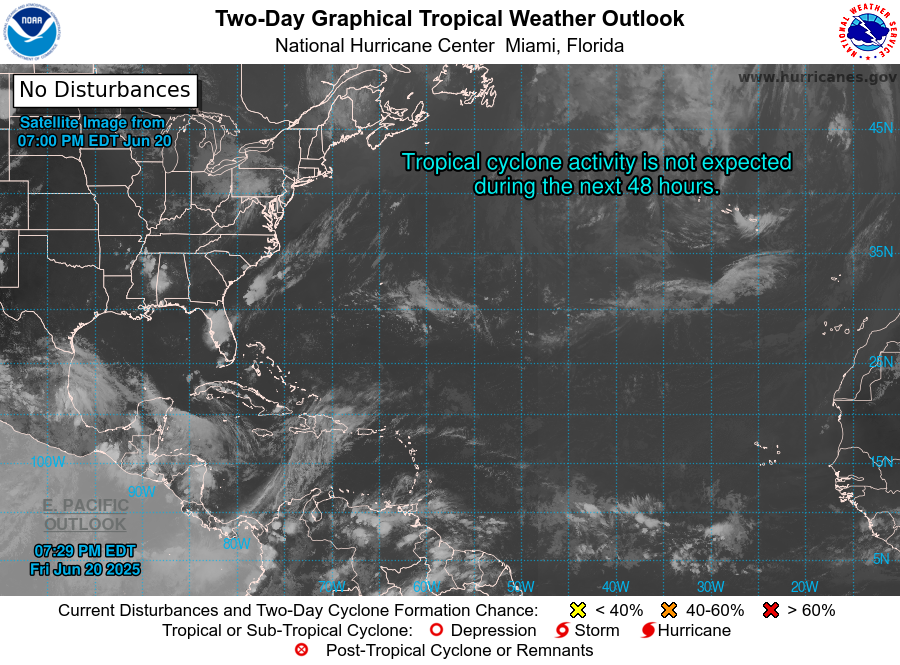
NWS Monitors Weather System In East Atlantic


From The National Hurricane Center:

Tropical Weather Outlook
NWS National Hurricane Center Miami FL
800 AM EDT Thu Aug 3 2017

For the North Atlantic...Caribbean Sea and the Gulf of Mexico:

A large area of showers and thunderstorms centered about 500 miles
southeast of the Cabo Verde Islands is associated with a vigorous
tropical wave. Environmental conditions are forecast to be conducive
for gradual development, and a tropical depression could form by
early next week over the eastern or central tropical Atlantic
Ocean. This system is forecast to move toward the west or
west-northwest at 10 to 15 mph for the next several days.
* Formation chance through 48 hours...low...30 percent.
* Formation chance through 5 days...medium...60 percent.


Friday, August 28, 2015

Tropical Storm Erika Aftermath


Erika skirted Puerto Rico's southern coast overnight, leaving behind
less damage, and less rain, than anticipated. Across most of the island,
between 1 and 3 inches of rain have been registered, which raised the
level of the Carraizo reservoir by 45 centimeters and La Plata's level
by 22 centimeters. A bit more rain is expected, and the morning is
still relatively windy. But for the most part, the weather event is ess-
entially over. It will be over for good around noon today.

As of this morning, about 246,000 households are without electrical
power, and around 250 people sought refuge in shelters across the
island. There are some downed trees and other moderate wind damage
across Puerto Rico, especially in the south. Damage was minimal
around the San Juan area, where there is little traffic this morning.
Road PR-167 through Comerio is still shut down. It was closed yes-
terday as a preventive measure. Many flights out of San Juan's main
airport remain cancelled, but the airport is open. The 'Dry Law' and
price controls will expire at 10:00 AM today.

Tropical Storm Erika is now affecting the Dominican Republic
and is expected to head towards Florida next.


Thursday, August 27, 2015

Tropical Storm Erika Coverage


Good morning, Puerto Rico. Keep checking this post throughout the
day and night today for information on Tropical Storm Erika, inclu-
ding closings, power outages, flooding, etc. If you have any infor-
mation you would like us to post, please leave it in the comments
section below or email us at embillpublishing@gmail.com. We al-
so encourage you to check our Twitter feed.

____________________________________________________________


9:25 PM: It seems like southern PR is still poised to take the
worst of Erika, after earlier forecasts had placed it closer to the
island's northeast, including Vieques and Culebra. Now it seems
like Ponce will take a direct hit from the storm's center (such
as it is). However, tropical storm force winds will be felt all 
across Puerto Rico until about noon tomorrow, and the rain will
then hang around for a little while after that. It is recommended
everyone stay inside until at least tomorrow evening and avoid
any unnecessary travel.

Strong winds have been felt already in the US Virgin Islands, and
the rain and wind are picking up in Vieques. The streets of the San
Juan metro area are eerily quiet as people hunker down in anticipa-
tion of worse weather.


Ferries between Fajardo & Vieques/Culebra will still be suspen-
ded tomorrow.


5:58 PM: We are now taking a break. We'll be back with updates
at around 9:00 PM ADT or sooner.

5:55 PM: Erika now expected to enter PR between Santa Isabel
and Ponce overnight, at abut 1 AM. San Juan will be very windy
around 11 PM. Storm will leave the local area at around 2 PM
tomorrow. 4-8 inches of rain forecast. Aír Europa, Jet Blue, Sea-
borne &  US Airways cancel flights. PR Government employees
will not be working tomorrow. No classes at public schools and 
courts will be closed. 

5:09 PM: A couple of items...Per US Coast Guard, all ports around
PR are closed. Also, there are no classes tomorrow at ANY of the
UPR campuses.

4:46 PM: 5 PM Nat'l Weather Svc advisory is out. Erika is finally
starting to take a turn towards the west/northwest, with a slight
slowing in forward speed to 15 mph. Max. sustained winds still
holding at 45 mph, barely tropical storm strength. Again, the real
danger with Erika will be the rain.

4:32 PM: Over 10,000 households reportedly without electrical
power already across the island.

4:28 PM: University of Puerto Rico Rio Piedras has announced
that there will be no classes or administrative activities tomorrow.
It's probably safe to say this will apply to all UPR campuses, but
so far announcement only applies to Rio Piedras.

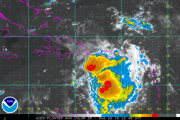
2:15 PM: Latest Erika satellite image:


1:43 PM: Now four are reported dead in Dominica due to Erika. Se-
veral people missing as well.

1:18 PM: Several public schools around Puerto Rico are being opened
to serve as shelters. Ernesto Ramos Antonini in Ponce is one of them.
Trying to obtain a list of more, will post here if we can find one. You
can call 3-1-1 or 787-723- 7707 for shelter information.

12:52 PM: Governor Padilla holds press conference, urges preparedness.
'Dry law' in effect from noon today to noon tomorrow, hotels/resorts
are exempt. Up to 12" of rain now expected to fall on the island due to
revised track.

12:42 PM: Government employees left work for the day within the last
hour. Lots of traffic around SJ metro area and beyond.

11:40 AM: Puerto Rico's consumer affairs agency, DACO, froze prices
for essential goods effective last night. This includes gas. Don't get
ripped off!

11:10 AM: From 11 AM advisory:

LOCATION...16.4N 63.3W
ABOUT 125 MI...205 KM W OF GUADELOUPE
MAXIMUM SUSTAINED WINDS...50 MPH...85 KM/H
PRESENT MOVEMENT...W OR 270 DEGREES AT 16 MPH...26 KM/H
MINIMUM CENTRAL PRESSURE...1006 MB...29.71 INCHES

10:50 AM: These airlines have cancelled flights: Cape Air, Trade-
wind & Seaborne.

10:35 AM: Looking rainy in Vieques...


10:30 AM: Three people dead in the Caribbean island of Dominica
in the wake of Erika's passing.

9:23 AM: 'Dry Law' will go into effect at noon today. If you want
to buy liquor, you'd better do it before then.

9:18 AM: American Airlines and US Airways expected to shut down
operations at Luis Muñoz Marín Int'l Airport at 6:00 PM today. Flights
to Florida over the weekend could be affected as well, since the storm
is expected to head in that direction.

9:10 AM: Govenor Padilla has activated the National Guard. Catholic
University of Ponce is suspending classes at noon today.

____________________________________________________________


Wednesday, August 26, 2015

Closings And Postponements Due To Erika


This page will be updated as new information comes in. Below are closings
and postponements happening tomorrow due to the expected passage of
Tropical Storm Erika.

** Dozens of flights out of San Juan's LMM Airport have been cancelled
     or delayed. Contact your airline before leaving for the airport. ** 

* Puerto Rico government offices and public schools in eastern part
   of Puerto Rico will be closed tomorrow and open until noon in 
   the rest of the island.

* Vieques/Culebra ferries from Fajardo: last ferry will leave Fajardo at 4:00
   AM Thursday. Last ferries from Vieques and Culebra will leave at 10:00
   AM.  After that, ferries will not operate again until further notice.

* Arecibo Observatory: Closed tomorrow and Friday.

* Amnesty International's screening of “Citizens of Nowhere” postponed until
   further notice.

* San Jose and Puerto Nuevo Diagnostic & Treatment Centers will remain
   open tomorrow for as long as weather conditions allow.

* San Juan non-emergency city employees are being advised to not come to
   work on Thursday. City offices will therefore be closed.

* El Yunque National Forest will be closed tomorrow. It may reopen Friday
   depending on conditions.

* The Bacardi Distillery in Cataño will be closed tomorrow Thursday.

* Instituto de Banca y Comercio: night classes cancelled tomorrow. Friday's
   schedule depends on conditions.

* National University College: No NIGHT classes Thursday. Friday's schedule
   depends on conditions.

* University of Puerto Rico, ALL Campuses: No classes or administrative activities
   on Thursday.

* Universidad Central de Bayamón: No classes Thursday.

* All Catholic schools in the Diocese of  Fajardo-Humacao: No class Thursday

* Colegio Bautista de Caguas: No class Thursday.

* San Juan YMCA: Closed tomorrow Thursday.

* Ana G. Méndez University System (All Schools) - Closing at 3:00 PM on
   Thursday. UPDATE: Classes will end at noon on Thursday now.

* Oriental Bank: Branches in Ceiba, Humacao, Las Piedras & Yabucoa open
   tomorrow 8:30 AM -10:30 AM. Other branches open until 3:00 PM.

* Sagrado Corazon University will end classes at noon Thursday.

* Universidad Interamericana will end classes at noon Thursday.


__________________________________________________________________


Puerto Rico News Digest For August 26, 2015


ERIKA TO AFFECT PR TOMORROW


The effects of Tropical Storm Erika are expected to be felt starting to-
morrow at around noon, and the system should be passing about 10 mi-
les north of Fajardo tomorrow evening. The National Weather Service
has issued a Tropical Storm Warning for Puerto Rico, Vieques, Cule-
bra and the US Virgin Islands. As of 8:00 AM, the storm was located
at 16.2N 56.8W, about 335 miles east of Antigua, and had maximum
sustained winds of 45 mph. Erika is moving west at about 17 mph, and
registered a barometric pressure of 1005 mb. Some strengthening is still
expected to happen over the next several hours. The tropical storm is ex-
pected to produce 2-4 inches of rain over Puerto Rico.

2 PM UPDATE: Erika now not expected to strengthen significantly
over next couple of days. Winds not a concern for land, but rather po-
tential flooding. Per the latest advisory, winds are still 45 mph with
higher gusts, and the storm is still moving west at 17 mph. Latest
coordinates are 16.3N 58.2W. Hurricane Hunter aircraft is on its way
to investigate further.

Keep checking The Puerto Rico Monitor for updates on Erika.


CARRAIZO LEVEL UP, LA PLATA DOWN


The rains produced by the remnants of Tropical Storm Danny helped ra-
ise the level of  the Carraízo water reservoir by 30 centimeters this mor-
ning, with its level currently at  34.04 meters. According to Alberto Lá-
zaro, President of AAA, the island's water utility, Carraízo's level would
have to increase by 2 to 2 1/2 meters in order for the water rationing plan
to be reduced to two days without running water from the current three
day plan. Despite Carraízo's gains, the La Plata reservoir's level has dro-
pped to 34.67 meters, 3.67 meters away from being out of service.


GOV'T CONSIDERS PRIVATE ELECTRICITY


From The San Juan Daily Star:

The government plans to open up power generation to the private sector,
virtually ending the monopoly of the Puerto Rico Electric Power Authori-
ty under the five-year fiscal adjustment plan. An outline of the plan, obtai-
ned by the STAR, states that the government will complete PREPA’s res-
tructuring of its $9 billion debt. The outline also says that PREPA will
“open up power generation to private competition to reduce electricity ra-
tes over time.” The private advisers to the change will be Alix Partners,
Millstein and Co., and Cleary and Gottlieb.


PREPA DROPS PETROBRAS AS FUEL SUPPLIER


From Caribbean Business:

The Puerto Rico Electric Power Authority (Prepa) announced Tuesday it
has entered into new supply contracts for fuel oil and natural gas used in
its powerplants, tapping Freeport Commodities and Natural Gas Aprovisi-
onamientos, which are scheduled to begin deliveries Oct. 1.The power uti-
lity will buy fuel oil No. 6 from Freeport Commodities, while natural gas
used at its Costa Sur powerplant will be supplied by Natural Gas Aprovi-
sionamientos, saving Prepa about $55 million from its previous contracts,
and replacing Petrobas, its previous provider.


ORLANDO NO. 1 SPOT FOR PUERTO RICANS


From The Orlando Sentinel:

Central Florida was the top destination of Puerto Ricans moving to the
mainland two years ago, according to new U.S. Census Bureau figures
released Tuesday. More than 7,500 Puerto Ricans moved to the Orlando
area in 2013, and most of them -- about 6,200 -- came from San Juan, the
island's capital, according to the Census Bureau. The New York metro area
was the next most popular destination, and it was the more popular choice
for residents of  Puerto Rico's smaller cities.


Tuesday, August 25, 2015

Tropical Storm Erika Forms In Atlantic


5:45 PM UPDATE: Last location for Erika: 15.6N 52.8W, about 605
miles east of Antigua. Maximum sustained winds 40 mph. Erika is
moving west at 20 mph. Tropical storm watches/warnings remain
unchanged. Some slight strengthening is expected over the next
couple of days.

---

Tropical Storm Erika has formed in the Atlantic and is moving west at 
a brisk 20 mph. The storm's coordinates as of 8:00 AM AST today were 
14.8N 50.2W, with the storm's center located about 750 miles east of the 
Leeward Islands. Barometric pressure is at 1003 mb, with maximum sus-
tained winds of 45 mph, just above the treshold for tropical storm status. 
Most models place Erika passing just north of Puerto Rico between Thurs-
day night and Friday morning. Some strenghtening is expected over the 
next couple of days, with tropical storm winds extending about 80 miles 
from the center of the system at this moment. A slight decrease in forward 
speed is expected during the next two days.

Tropical Storm Watches are currently  in effect for Montserrat, Antigua, 
Barbuda, St. Kitts and Nevis, Anguilla, Saba, St. Eustatius and St. Maarten. 
A Tropical Storm Watch means that tropical storm conditions are possible 
within the watch area, generally within 48 hours.


Thursday, August 20, 2015

Tropical Storm Danny Taking Its Time


Tropical Storm Danny continues to slowly move west/northwestward
at about 10 mph, as of today's 5 AM advisory. Maximum sustained winds
are holding steady at 50 mph, with a barometric pressure of 1000 mb. The
storm was located at 12.2N 43.7W, about 1200 miles east of the Antilles.

According to the National Hurricane Center, the storm's structure has
improved over the last several hours, and is forecast to strengthen over
the next two to three days, after which it may see some weakening as it
encounters dry air in the eastern Caribbean. The center of Danny is expec-
ted to pass just south of Puerto Rico early on Tuesday, although no wat-
ches or warnings have been issued at this time. Keep checking the Puer-
to Rico Monitor (as well as our Twitter feed) for the latest on Tropical
Storm Danny.

The next advisory from the National Weather Service will be issued by
11:00 AM AST today.


11:00 AM UPDATE: Danny is now officially a hurricane. Maximum
sustained winds are now at 75 mph, pressure at 992 mb. Location is 12.5N
44.8W,  moving West/Northwest at a slightly faster 12 mph. Danny is now
about 1090 miles east of the Windward Islands. Hurricane-force winds on-
ly extend outward up to 10 miles from the center and tropical-storm-force
winds  extend outward up to 60 miles.